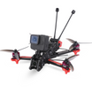
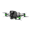
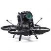
The increasing popularity of sustainable agricultural practices has led to an upsurge in the use of drones in the agriculture industry. UAVs are invaluable in the imaging and analysis of crop productivity, disease and land utility. Drones have found a variety of uses in agriculture both as a farming aid, such as in spraying of pesticides, as well as in imaging and image analysis technologies. Goldman Sachs predicts that agriculture will be the largest user of drone in the next five years
Application of Chemicals
The DJI Agras MG-1 is an example of a UAV that finds use in agriculture for the application of pesticides, herbicides and fertilizers. Drones with a high power and load-bearing capacity are ideal for such uses.
Imaging and Monitoring
Multispectral and hyperspectral aerial imaging is key to monitoring what is known as Normalised Difference Vegetation Index (NDVI) that is a measure and indicator of a variety of crucial agricultural parameters such as vegetation density and cover, soil health etc. An important piece of information indicated by NDVI is in plant counting and crop growth monitoring, that can form the basis for judgement of replanting, fertilizer application, etc.
Canopy Chlorophyll Content Index (CCCI) can measure intensity of green colour and thus, chlorophyll content of plants, and can indicate plant health and monitor for chlorosis or associated plant diseases, often providing early warnings that may not be identified by eye or even grounded cameras.
Proper irrigation is paramount for a healthy crop. Drone images can study soil colour and water content to derive data about irrigation efficacy and drainage, informing the farmer about the addition of pipes and drainage systems to maintain crop health.
Drones also provide valuable information regarding crop damage that may be caused by drought, fires, floods, pestilence and other natural disasters and can be used to gauge how to respond to loss of crops, as well as produce tangible data for use by insurance companies to recompense losses.
Mapping is another useful tool in agriculture, giving farmers information and even detailed maps on the spread and cover of their crops, and even data on the variation of soil quality along terrain, measure the total planted area of different crops on the same farm and even recommend and mark out areas that need additional attention such as increased fertilizer and pesticide application.
Precision phenotyping is another application of drone technology, as aerial images can track specific breeds of the crop and the gene pool of each such variant to inform choices on crop selection for further iterations of the cropping cycle.
As imaging technology improves, drones are increasingly capable of both diagnostic and predictive data collection, data that can help massively boost productivity and profitability of crops, minimise wastage, protect from disasters and improve sustainability of crops. In the face of climate change and shifting and unreliable weather on a global scale, drones may be the best answer to securing food supplies and farming economies in the future.
For more such informative content visit : https://insidefpv.com/blogs/
Follow us on Linkedin for latest updates : https://in.linkedin.com/company/inside-fpv

