
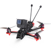
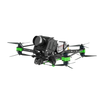
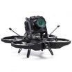

3D imaging is a novel technology that allows individuals to visualise 3D spaces on the small scale of an image. 3D models are three-dimensional representations of an object created by plotting points in a 3D space along the X, Y and Z axes. The points are connected to form geometric shapes like triangles, parallelograms and curved surfaces, and compiled to form a single coherent image. There are typically three ways to generate 3D models: using 3D modelling software, certain algorithms, or by scanning physical objects to generate 3D images of them. Drones play a crucial role in the third, acting as airborne scanners and helping generate models through a process known as photogrammetry.
Photogrammetry
Photogrammetry is the process of taking measurements from photographs. Drones capture photographs from two or more different locations at different angles. The images are then analysed to produce a series of points that are common between the images, and the location data of the images are used to triangulate the points, using the shifts in their relative locations to produce 3D images. It is highly similar to what happens in our eyes, with each eye capturing a slightly different image and the brain putting them together to give us 3D vision.
The more photographs of the target location, the more accurate the model. A crucial advantage drones have in the generating of photographs for modelling, in addition to their range and mobility, is that all images are geotagged, i.e., the location and angle of the photograph is included in the metadata of each image. This means that modelling software can process the images directly without the user having to provide any data.
Optimising Photography for Photogrammetry
There are several established best practices in aerial photography to create an accurate 3D model for a drone. The pictures taken must have a 60-70% overlap. If needed, pilots can take the help of applications like DroneDeploy and Pix4D Capture to generate automatic flight paths that can simplify the process of taking pictures from the right angles. The best set of photographs to take are:
- A straight downward image captured at an altitude of 100-200 feet.
- Multiple images from circling the target location at a high altitude and a 30° camera angle.
- Then a circular path at an intermediate altitude (can be 100-200 feet or so) with a 45° angle.
- Finally, fly around the location at a low altitude with an approximately 70° angle.
Applications of 3D modelling
3D images of large-scale locations from drones find great use in a variety of fields. Industrial inspections, surveillance, agriculture and mapping are just the common uses. The true limits of drone imaging is still unknown and new applications are being found constantly.
For more such informative content visit : https://insidefpv.com/blogs/
Follow us on Linkedin for latest updates : https://in.linkedin.com/company/inside-fpv

