In an era where decisions are made in seconds, access to live data from above has become more than a technological upgrade. It has become a necessity.
Real time drone surveillance is transforming how industries operate under pressure. From rescue missions and military operations to environmental monitoring and infrastructure security, drones are playing a vital role in situations where every moment matters.
But what exactly makes this technology mission critical? Let’s see.
What Does Real Time Drone Surveillance Actually Mean?
Before understanding its importance, let’s explore the term itself.
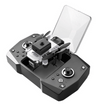
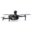
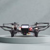
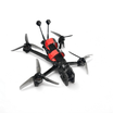
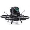
Real time drone surveillance refers to drones equipped with live streaming capabilities. This allows them to send high resolution video and data instantly to teams on the ground.
It also includes visual footage, thermal imaging, GPS positioning, and even environmental data. Unlike traditional drone use where footage is reviewed after the fact, real time surveillance offers immediate insights allowing us to make smarter decisions.
Also read: How insideFPV fits in India’s leading drone defense future
The Rising Importance of Live Aerial Intelligence
Situations involving safety, strategy, and coordination demand tools that offer instant clarity.
Speed and accuracy during emergencies
Natural disasters, fires, or accidents often leave responders with little time to assess the situation. Drones can cover large areas quickly and transmit what they see in real time. This helps rescue teams pinpoint locations of trapped victims, identify safe routes, or detect threats like gas leaks or collapsing structures.
In the 2023 earthquake that hit Turkey and Syria, drones played a key role in locating survivors under rubble within minutes of deployment. They offered perspectives that humans could not access on foot.
Military precision in modern conflicts
Armed forces rely heavily on up to the second intelligence. Drones allow units to monitor enemy movement, survey terrain, and track activity without putting soldiers in danger. This level of awareness leads to better coordination and reduces risk during operations.
The Bayraktar TB2 drone, for example, became a crucial asset during conflicts in Eastern Europe. It helped military units make real time decisions that directly impacted outcomes on the ground.
Infrastructure monitoring without delay
For industries that manage pipelines, highways, power grids, or railways, constant surveillance is essential. Real time drones help spot issues like corrosion, intrusions, or breakdowns before they escalate.
A drone flying above an oil pipeline can detect changes in temperature or small leaks that would be impossible to notice from the ground.
Also read: Drones + machine learning = Real time threat detection
The Technology That Makes It Work
Real time surveillance depends on a combination of hardware and software working seamlessly together.
Reliable and fast data transmission
Live surveillance is only useful if it can be viewed without delay. Drones use 5G, satellite links, and dedicated radio frequencies to transmit data instantly. Some systems also work with private mobile networks in remote or mission sensitive zones.
These connections are encrypted and stable, allowing teams to monitor footage from thousands of kilometers away with minimal lag.
High quality imaging and environmental sensors
Drones built for surveillance are not your everyday gadgets. They come fitted with zoom capable HD cameras, thermal sensors for night vision, and LiDAR technology that maps 3D surfaces. This allows them to see beyond what a normal camera or human eye could capture.
In addition to visuals, drones collect temperature readings, chemical levels, and motion data, making them complete intelligence tools.
Onboard artificial intelligence
Many surveillance drones now include AI processors that work right from the sky. This onboard computing lets the drone identify objects, read license plates, count people, and detect suspicious behavior, all in real time.
For example, in a wildfire, AI can help highlight areas of high heat and recommend paths for evacuation. This reduces human workload and speeds up decision making on the ground.
Also read: Defense drones: Overview and India’s advancements
How Different Sectors Use Real Time Drone Surveillance
From public safety to agriculture, the applications of this technology are expanding rapidly.
Disaster response teams
Drones can fly over areas affected by floods, landslides, or earthquakes to find survivors, evaluate damage, and guide emergency crews.
In 2024, when wildfires hit parts of California and Hawaii, drones provided real time views that helped manage evacuations and locate trapped residents.
Law enforcement and crowd control
Cities are increasingly using drones during large public events, protests, or traffic congestion. With live drone footage, police can monitor crowds, track vehicles, and respond to incidents faster.
For instance, during a New Year’s Eve celebration in Dubai, drones were used to oversee large crowds and spot emergencies without needing physical patrols everywhere.
Environmental monitoring and wildlife protection
Drones are helping protect forests, oceans, and wildlife in places where ground patrols are limited. Organizations tracking deforestation or illegal hunting use real time footage to detect activity as it happens and take immediate action.
In the Amazon rainforest, drones have become the go to surveillance tool for identifying illegal logging routes that satellite images often miss due to cloud cover.
Industrial inspections and safety checks
Companies managing energy grids, power stations, or remote facilities use real time drones for routine inspections. Instead of sending workers into dangerous environments, they rely on live drone feeds to inspect equipment, track performance, and flag safety risks.
This saves time, reduces costs, and improves safety all at once.
Key Challenges That Still Need Solving
As powerful as this technology is, it comes with limitations.
Network availability in remote locations
Real time streaming depends on reliable connections. In remote areas like deserts, mountains, or battlefields, maintaining signal strength can be a challenge. While satellite options exist, they are costly and still under development.
Managing large amounts of data
Streaming HD video from the sky around the clock produces an overwhelming amount of information. Without smart filtering or AI assistance, teams can miss important details buried in endless footage.
Privacy and legal concerns
Using drones in public spaces brings up questions about personal privacy. Some cities and countries have introduced strict rules about where drones can fly and what they can record. Clear policies are essential to ensure that surveillance is done ethically and legally.
Also read: Why India is betting big on Kamikaze drones
What the Future Holds for Real Time Drone Use
Innovation in drone surveillance is accelerating faster than ever.
Autonomous swarms and collective intelligence
In the near future, we will see fleets of drones working together to monitor large areas from multiple angles. These swarms will share information and coordinate their paths without human intervention, offering full coverage of cities, borders, or disaster zones.
Deeper integration with smart cities
Drones will become part of connected city infrastructure. They will respond automatically to alarms, accidents, or environmental changes.
Expanding civilian applications
Delivery drones, agricultural scouts, and traffic monitors will all use real time surveillance to optimize their tasks. Whether it is tracking crop health or spotting potholes, drones will become essential for managing everyday life more efficiently.
Frequently Asked Questions
What is the main advantage of real time drone surveillance?
The biggest advantage is instant access to aerial data, which allows teams to make faster and more accurate decisions during emergencies, inspections, or operations.
Can drones stream video without the internet?
Yes. Many drones use private networks, radio links, or satellite connections to transmit footage even in places where internet access is limited or unavailable.
Is real time drone monitoring legal in cities?
It depends on local laws. Many cities require permits or restrict drone flights near sensitive areas. Operators must follow regulations to ensure privacy and public safety.
What kind of industries use real time drone surveillance the most?
Key users include defense, law enforcement, disaster management, infrastructure companies, and environmental organizations.
How does AI improve drone surveillance?
AI helps drones identify people, vehicles, threats, and patterns while in flight. This reduces the need for constant human monitoring and increases the speed of decision making.

