


Climate change is one of the most pressing issues of our time. With rising global temperatures, melting glaciers, and extreme weather becoming the norm, the need for accurate environmental monitoring has never been greater.
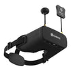
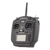
Traditional data collection methods often fall short in terms of accessibility, precision, and cost. That’s where drones, also known as unmanned aerial vehicles (UAVs) are proving to be quite useful.
Below, we’ll break down how drone technology is being used to track climate change and the key areas where drones are making an impact. Also you will read why they’ve become an essential tool for climate scientists and environmental organizations around the world.
What Makes Drones Ideal for Climate Monitoring?
Unlike satellites or ground-based sensors, drones can fly at low altitudes, access hard-to-reach areas, and collect high-resolution, real-time data. This flexibility allows for targeted environmental monitoring, where researchers can track changes in a specific ecosystem, glacial region, or coastline over time.
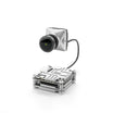
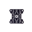
Modern drones are equipped with advanced tools such as:
-
Multispectral cameras for vegetation and land analysis
-
Thermal imaging sensors for heat signature detection
-
LiDAR (Light Detection and Ranging) for topographical mapping
-
Air quality sensors for tracking pollutants and greenhouse gases
Because of their versatility, drones are helping scientists build more accurate climate models and respond faster to environmental changes.
Also read: The components you require to build an FPV drone
Top 6 Ways In Which Drones Uncovering The Truth About Climate Change
Let us go through six ways in which these UAVs are exposing the reality about climate.
#1 Monitoring Glaciers and Polar Ice Melt
Traditional monitoring of melting glaciers often depends on satellite imagery or risky manned expeditions. Drones are now replacing these outdated methods by providing detailed, 3D mapping of ice sheets and real-time visual data on melting patterns.
In places like Greenland and Antarctica, drones equipped with LiDAR and thermal sensors help scientists:
-
Track glacier retreat
-
Measure surface temperature
-
Monitor meltwater flow
-
Assess changes in ice thickness
These drone-based insights are critical for understanding sea-level rise and predicting future coastal impacts.
#2 Tracking Deforestation and Land Use Changes
Forests act as carbon sinks, absorbing massive amounts of CO₂ from the atmosphere. But illegal logging, slash-and-burn agriculture, and urban expansion continue to drive deforestation, especially in sensitive regions like the Amazon, Congo Basin, and Southeast Asia.
Drones help environmental organizations:
-
Detect illegal land clearing in real-time
-
Monitor forest health using multispectral imaging
-
Track reforestation and afforestation efforts
-
Analyze changes in carbon sequestration potential
By using drone mapping and aerial imagery, conservationists can respond faster and with more precision to changes on the ground.
Also read: 10 real word use cases of defence drones in 2025 conflicts
#3 Observing Coastal Erosion and Rising Sea Levels
Coastal erosion is intensifying due to rising sea levels and more frequent storm surges. Monitoring these changes with ground teams or satellites can be slow and inaccurate. Drones offer a faster and more affordable way to assess coastal damage and predict future erosion patterns.
Applications include:
-
Mapping shoreline retreat over time
-
Measuring tidal movements and flood zones
-
Documenting the impact of hurricanes and tsunamis
-
Supporting coastal city planning and disaster preparedness
Drone-collected data allows engineers and policymakers to design smarter coastal defenses and prioritize areas for adaptation projects.
#4 Agricultural Monitoring in a Changing Climate
Climate change is disrupting rainfall patterns and causing more frequent droughts. Agricultural drones are now being used by farmers and researchers to adapt to these shifts.
With the help of aerial imaging and thermal sensors, drones can:
-
Identify drought-affected zones
-
Monitor crop health and soil moisture levels
-
Optimize irrigation systems
-
Detect pest or disease outbreaks early
Drone technology supports climate-resilient agriculture by helping farmers make data-driven decisions. This includes reducing water waste, and protecting yields in the face of changing weather patterns.
#5 Tracking Wildlife and Ecosystem Shifts
As habitats shift due to global warming, many species are migrating to new areas or facing extinction. Drones help track animal populations and ecosystem changes without disturbing the environment.
Wildlife researchers use drones to:
-
Monitor animal migration patterns
-
Count population numbers in remote regions
-
Study behavior under changing environmental conditions
-
Map habitat loss due to temperature or vegetation changes
Drones are especially useful in monitoring species like polar bears, caribou, sea turtles, and mountain gorillas. Because this is where ground access is limited or dangerous.
#6 Detecting Greenhouse Gas Emissions and Air Quality
Measuring greenhouse gases accurately is crucial for both research and regulation. Drones equipped with gas sensors are now being deployed to:
-
Identify methane leaks in oil and gas fields
-
Monitor CO₂ levels in agricultural and industrial areas
-
Track emission hotspots near landfills or livestock farms
-
Support compliance with environmental regulations
By flying directly into emission zones, drones can gather real-time air quality data, offering a more dynamic and localized view than stationary monitors.
Drones are no longer just flying cameras. They’ve become one of the most effective tools in climate science, offering fast, accurate, and flexible ways to track environmental change. Whether it’s monitoring glaciers, tracking deforestation, measuring emissions, or supporting sustainable agriculture, drones are helping researchers get closer to the ground truth of climate change.
Frequently Asked Questions
How are drones better than satellites for tracking climate change?
Drones can fly at lower altitudes, collect real-time imagery, and focus on specific areas with pinpoint accuracy. This makes them ideal for monitoring changes in glaciers, forests, coastlines, and air quality. Unlike satellites, drones can be deployed quickly, repeated as needed, and equipped with specialized sensors for tailored climate studies.
What types of climate data can drones collect?
Drones can collect a wide range of environmental data including surface temperatures, vegetation health, soil moisture levels, greenhouse gas emissions, coastal erosion rates, and glacial thickness. Equipped with tools like LiDAR, multispectral cameras, and air quality sensors, drones help scientists track deforestation, monitor wildlife migration, assess crop conditions, and detect methane leaks.
Are drones used in both urban and remote climate monitoring?
Yes, drones are highly effective in both urban and remote environments. In cities, drones are used to monitor air pollution, heat islands, and emissions from industrial zones. In remote areas like polar regions, forests, and deserts, drones collect data on glacial melt, deforestation, wildlife behavior, and ecosystem changes.

